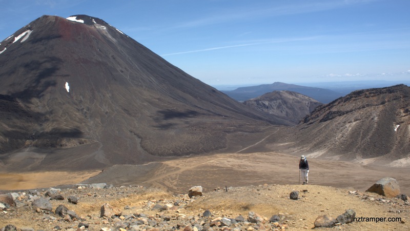
Trails: Mangatepopo Road road end car park and shelter – Tongariro Alpine Crossing Track – Junction to Whakapapa Village – Junction to Mangatepopo Hut – Soda Springs (5 minutes side track) – Junction to Mt Ngauruhoe Summit 2287m – South Crater – Red Crater – Junction to Mt Tongariro Summit 1967m – Emerald Lakes – Junction to Norhtern Circuit Oturere Hut – Central Crater – Blue Lake – Ketetahi Hut – Ketetahi shelter and car park.
Car Park: Yes. Mangatepopo Road road end car park and shelter “-39.14458,175.58087”
Ketetahi shelter and car park “-39.07377,175.66373”
Public Toilet: Yes
Weather: Check Weather before you go!
Note: Do not try if the weather is not good enough! Private car parking may not be allowed during peak season at Mangatepopo Road road end car park and shelter.
For better map display, click the buttons (Full Screen, Hide/Show Photos and Back to Center) in the top right corner of the map to study the tracks we took or any other tracks.
Max elevation: 2262 m
Min elevation: 763 m
Total climbing: 1667 m
Total descent: -2018 m
Average speed: 4.37 km/h
Total time: 09:02:36
Difficulty Rating: 5.24 – H
The “Total Time” is my time in November which includes morning tea time and lunch time and breaks. That day was fine and the track was good. The Tongariro Crossing is about 19.8km without side track to Mt Ngauruhoe Summit. If you slow down to average 3.5km/h plus 90 min stop then the total time will be around 7hrs. Climbing Mt Ngauruhoe Summit will take you another 2.5hrs.
Photos on the map. Click opened photo to close.
Click this photo below to enjoy more original large size photos of this track!
Play this video to learn more about this track! Recommend 720+ HD for best quality video!


A 30 minutes video was added to the tramping post "Tongariro Alpine Crossing plus Mt Ngauruhoe"
Tramping post update: Tongariro Alpine Crossing plus Mt Ngauruhoe. Video coming soon later