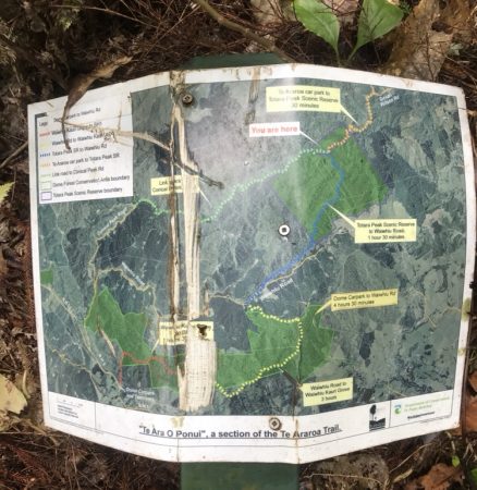
Part of Te Araroa Trail: Dome Tearooms carpark – Dome Forest Walkway – The Dome Summit – Waiwhiu Kauri Grove – off bush private 4WD pine forest road – Waiwhiu Valley Rd – Cross Waiwhiu Stream into bush walk along the stream- off stream uphill to Totara Scenic Reserve – Junction of Link Track to Conical Peak Rd – Private 4WD road track – Govan Wilson Road – Matakana Valley Rd – Te Araroa Trail in Omaha Forest until Tamahunga Summit and return the same way back.
Car Park: Yes. 70km 50 minutes from Auckland.
Toilet: Yes
Weather: Check weather before you go.
For better map display, click the buttons (Full Screen, Hide/Show Photos and Back to Center) in the top right corner of the map to study the tracks we took or any other tracks. For more information about Puhoi, you may go to www.teararoa.org.nz
Max elevation: 430 m
Min elevation: 141 m
Total climbing: 2345 m
Total descent: -2338 m
Average speed: 5.43 km/h
Total time: 08:08:35
Above data was extracted from 2/3 points of original record to keep upload speed. Recorded by 935.
(Original record) Total real distance: 39.1, Total flat distance: 38.2 km, Climbing distance: 12.1 km, Descent distance: 12.8 km, Flat distance: 14.1 km, Maximum difference: 291 m, Final balance: 0m.
Difficulty Rating: Tough in winter!
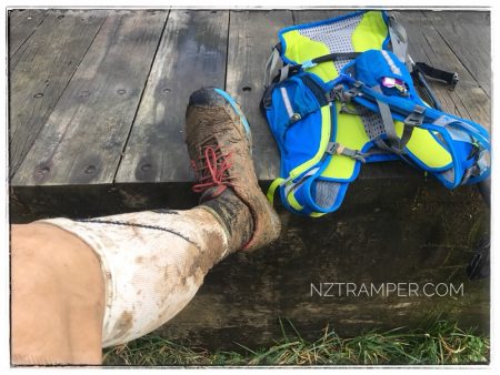
The “Total Time” is my time in July which includes drinking breaks and stops. That day was sometimes cloudy, rainy, windy and fine and most of trail was muddy and boggy, very slippery and some section overgrown. My first time running in night! Video and photo in Instagram. MMM event 2018.